
Nature projects with documentation that stands up to scrutiny.
Under the Green Tripartite (Grøn Trepart), municipalities must be able to show what has been decided, why, and what difference it has made. Freyra brings drone photographs, public data and expert verification together in a single evidence chain.
The municipality must be able to stand behind the figures.
Nature and land projects face requirements from foundations, residents, politicians and partners. When the underlying material is scattered, each question becomes a task in its own right.
Foundations and grant schemes require a verifiable basis, before and after the project.
Landowners, advisers and stakeholders need access to the same factual basis.
Photographs, maps and reports are stored in folders and emails and are difficult to find again two years later.
A shared, verifiable basis.
One baseline report per area with drone photographs, public data and expert verification. It follows the same structure across all areas.
Packages for funding applications, tripartite meetings and political consideration. Every claim has a source.
Fixed positions for before-and-after documentation, so changes can be tracked over time.
Access to your own projects in Freyra Evidence Workspace. The material does not disappear when a member of staff changes jobs.
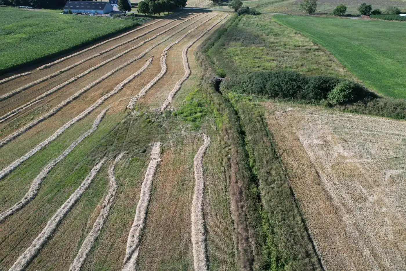
Baseline survey of a watercourse in Southern Jutland.
This is what an actual deliverable looked like. The area has been anonymised.
- Drone flight completed on 24.08.2026
- 5 sections surveyed along the watercourse
- 6 repeat survey points for before-and-after documentation
- 21 reference photographs with GPS, ready for return visits
- A basis for the local tripartite partnership
- Supporting documents for funding applications
- A fixed starting point for follow-up in a year's time
- Answers to residents and politicians with source references
The municipality has access to its own material.
With a login to Freyra Evidence Workspace, your team can find projects, baselines and evidence packages in one place. Without having to ask us first.
Access to your own projects, version history and sharing of evidence packages with foundations and partners. The municipality controls who has access.
Frequently asked questions
A pilot project starts from DKK 125,000 and gives you a complete evidence chain on which to assess its value.
Read more
Shall we look at your project area?
A no-obligation conversation about your area, your data and what a baseline survey can offer you.